October 19, 2022
By Lea Nickless, Curator
Later this month, The Wolfsonian–FIU opens a new collection-based exhibition, Plotting Power: Maps and the Modern Age. Featuring more than 170 maps, globes, and other geographically inspired material from around the world, Plotting Power parses the many roles mapmaking and graphic imagery have played in shaping culture, in forging alliances, and—not surprisingly—in waging war.
I have traced many connective threads through the collection in my years of in-depth research and curation, but few that are so global in scope. I am lucky to have had the unique perspective of watching The Wolfsonian grow piece by piece, each acquisition adding to a wildly complex, multi-layered document of the human experience between 1850 and 1950. Affording me a bird's-eye view of modern material culture, this career has sparked a sort of obsession—the thrill of connecting dots, the drive to find meaning, and the joy in sharing new insights felt just as keenly by our founder, Mitchell "Micky" Wolfson, Jr., and my many colleagues. Through collection-centric exhibitions like this one, which touches on all aspects of map-related imagery from examples of conflict to those of peace and bridge-building, I hope we can reveal what Micky envisioned all along: truth as testified by object.
For additional details on the show and about what we want visitors to take from it, I encourage a review of the exhibition's press release. I'm also happy to share that Plotting Power will be accompanied by a 100-page, 53-plate companion publication, the product of months of effort and collaboration between multiple departments. The opening of my essay—excerpted here—sets the scene for the rich visuals and complex histories told through the objects and items I present in the book and in the show.
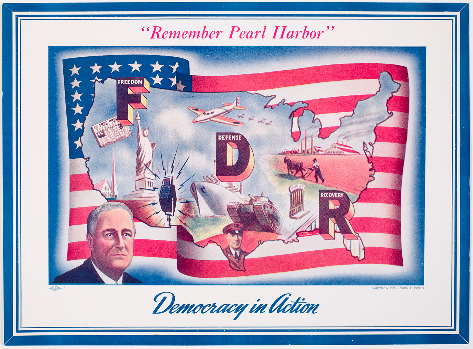
When President Franklin D. Roosevelt addressed the American public during a "fireside chat" radio broadcast soon after the United States entered the Second World War, he urged listeners to "take out and spread before you a map of the whole earth." This would be a war different from others, he said, not only in its methods and weapons but also in its vast geography. Underscoring the association between geographical knowledge and power, Roosevelt's mandate speaks to the significance of maps in the modern age, when ambitions, conflicts, and technologies exploded in scope and scale.
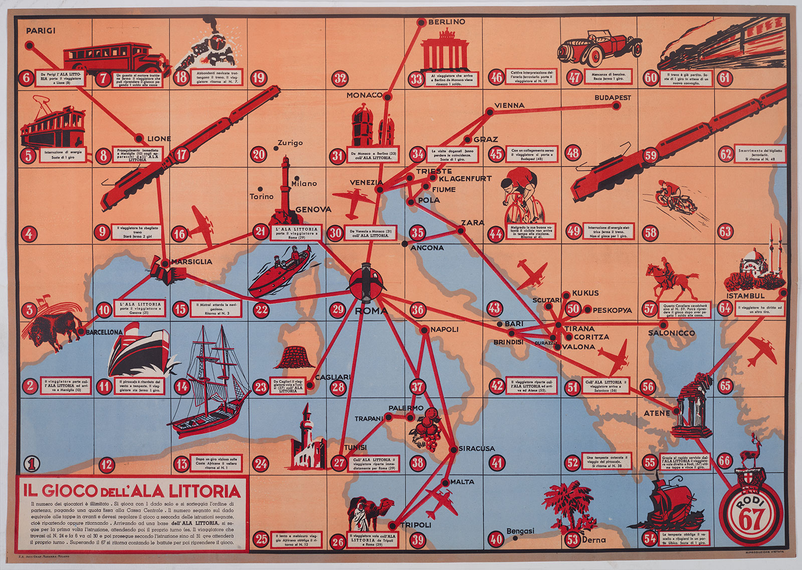
The one hundred years covered in The Wolfsonian's collection (1850–1950) witnessed unprecedented change. As upsurges in industrialization, immigration, and imperial expansion as well as two world wars transformed and complicated the globe, geographic imagery offered a means to create order out of the chaos. Cartographic advancements and technological innovations in printing had made maps more widely accessible; in the U.S., for example, they were published by oil companies and distributed for free in gas stations, printed in newspapers and magazines, and posted in classrooms. No longer reserved for the privileged elite, maps and the ready availability of mass-market cartography expanded geographic literacy for an increasingly mobile society. Graphic references to maps and globes also became more frequently integrated in objects and media of all sorts.
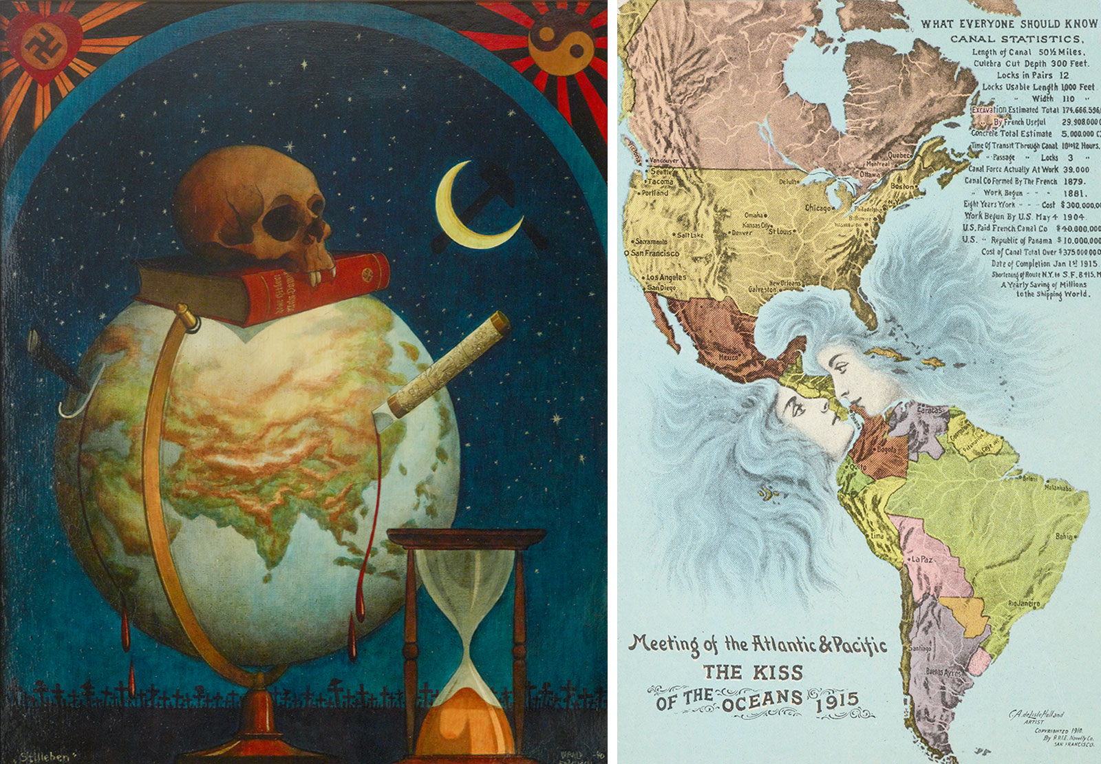
Institutions of power and producers of geographic imagery have long recognized the value and authority of map-related references in influencing the thinking of diverse audiences. Nations, corporations, the media, and multinational political alliances too have used maps for the visualization of data and to associate themselves with the larger world. They also, at times, have exploited the persuasive powers of maps for less benign agendas. While sometimes considered strictly scientific depictions of reality, maps are likewise a reflection of an existing collective narrative, presenting spatial relationships through ever-shifting political, cultural, and societal filters. Maps are informed by choices—what to include or exclude, what to emphasize or ignore. When these choices are driven by economic, nationalistic, or political interests, maps can become agents of manipulation with immense power to form global views.
Focusing primarily on the first half of the twentieth century, the Wolfsonian exhibition Plotting Power: Maps and the Modern Age examines diverse geographic representations in a wide range of media, focusing on their intended objectives. While maps, globes, and graphic materials relating to geography can be read at face value, they are in fact subjective interpretations of spatial reality, their information filtered by deliberate choices. This essay, like the exhibition, explores questions of "whose choices, why, and for whom?" and offers insights into the interests and intentions behind the imagery.
Want more? Visit the museum starting October 28 to explore the exhibition, and fill out a book request form to secure your copy of the publication (issues expected in November; shipped domestically or available for pickup at the Design Store).